Tile requests
Product requests
Static satellite map images
Tile requests
There are multiple methods for requesting tiles from Global Satellite. ZXY and ZYX formats provide a means of identifying tiles directly by coordinates, while quadkey identifies tiles by a unique code.
ZXY and ZYX format
The ZXY URL format is a standard Google format. It requires the zoom level (z), the x coordinate (x), the y coordinate (y), and a full time and date for the requested weather data. These four variables determine which tile is returned by the call and what information it contains.
| https://{{api} or {apidev}}.accuweather.com/maps/v1/satellite/globalIR/zxy/{yyyy-mm-dd}T{hh:mm:ss}Z/{zoom}/{x}/{y}.png?apikey={your key}&display_mode={display mode} |
The ZYX URL format is nearly identical but will return the most recent tile for the provided location. Date and time are not necessary for this call. The call is redirected (via 302 redirect) to an altered response URL that includes the appropriate date and time.
| https://{{api} or {apidev}}.accuweather.com/maps/v1/satellite/globalIR/zxy/tile/{zoom}/{x}/{y}.png?apikey={your key}&display_mode={display mode} |
Example
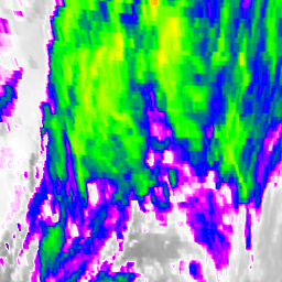
A simple search for a specific tile with a zoom level of 4, at coordinates X=9 and Y=4 will look like this:
| https://api.accuweather.com/maps/v1/satellite/globalIR/zxy/4/9/4.png?apikey={your key} |
The call will redirect to the most recently available time and date for that tile, and the response will be the specified tile showing current weather data::
Top of page
Quadkey format
This method is used to get tiles in the quadtree key (quadkey) format used by Microsoft. Quadkey is an alternative method for identifying individual tiles in a map grid. Instead of separating values, it combines all identifying factors into a solid numerical string. The correct URL formatting is shown below.
| https://{{api} or {apidev}}.accuweather.com/maps/v1/satellite/globalIR/quadkey/{quadkey value}.png?apikey={your key}&display_mode={display mode} |
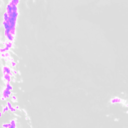
Tile requests that yield no graphical data will redirect to a blank tile. See below for details.
Example
Top of page
Blank tiles
If a tile request yields no graphical data, the API returns a generic blank tile. The URL redirects to a static address that contains the blank tile. The correct URL formatting is shown below.
| https://{{api} or {apidev}}.accuweather.com/maps/v1/satellite/globalIR/blank.png?apikey={your key}&display_mode={display mode} |
Top of page
Product requests
List available products
Returns a list of available products within the Global Satellite API. This function can be used to move the map to a specific product. The correct URL formatting is shown below.
| https://{{api} or {apidev}}.accuweather.com/maps/v1/satellite/globalIR/request_products?apikey={your key}&locations={boolean} |
Setting locations to true will return an extra object within each product that provides a bounding box for that product.
Example
Top of page
List active products
Returns a list of products within the current map bounding box. The correct URL formatting is shown below.
| https://{{api} or {apidev}}.accuweather.com/maps/v1/satellite/globalIR/preferred_box_products?apikey={your key}&toplat={north latitude}&bottomlat={southern latitude}&rightlon={eastern longitude}&leftlon={western longitude}&zoom={zoom level}&attribute={boolean} |
Example
Top of page
Request frames for products
Returns a list of mutual frames for all listed products. The correct URL formatting is shown below.
| https://{{api} or {apidev}}.accuweather.com/maps/v1/satellite/globalIR/preferred_product_frames?apikey={your key}&products={major}-{minor},{major}-{minor},{major}-{minor},...&attribute={boolean} |
Example
Top of page
Request frames for box
Returns a list of frames within the current map bounding box. The response includes attributions. The correct URL formatting is shown below.
| https://{{api} or {apidev}}.accuweather.com/maps/v1/satellite/globalIR/preferred_box_frames?apikey={your key}&toplat={north latitude}&bottomlat={southern latitude}&rightlon={eastern longitude}&leftlon={western longitude}&zoom={zoom level}&attribute={boolean} |
Example
Top of page
Request products for tiles
Returns a list of products within a specified map bounding box. The top left corner of the box is defined by X1, Y1 and the bottom right corner of the box is defined by X2, Y2. The correct URL formatting is shown below.
| https://{{api} or {apidev}}.accuweather.com/maps/v1/satellite/globalIR/preferred_tile_products?apikey={your key}&x1={top left x coordinate}&y1={top left y coordinate}&x2={bottom right x coordinate}&y2={bottom right y coordinate}&z={zoom level}&attribute={boolean} |
Example
Top of page
Static satellite map
Returns a static weather satellite image that includes a base map image in a single file.
Static satellite map by city
Seach by city to return a localized satellite map image.
Example
Top of page
Static satellite map by admin area
Search by political division within a country such as state or province.
Example
Top of page
Static satellite map by country
Example
Top of page


